IN OAXACA CITY |
||||||||||||||||
|
||||||||||||||||
 |
||||||||||||||||
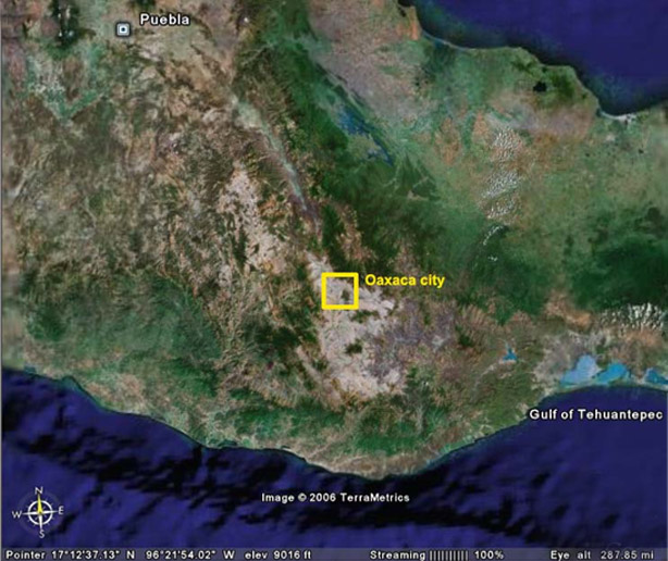
Oaxaca City is the capital of the state. It is situated about 500 kilometers from Mexico City, and about 250-300 kilometers from the Pacific coast. With a little over 3 million inhabitants, the city lays in the central valleys of the state, surrounded by an intricate labyrinth of mountains and irrigated by the river Atoyac. |
||||||||||||||||
|
||||||||||||||||
In August, the weather should be warm (approximately average high 28.9° C / 83° F, average low 15.5° C / 60° F, mean 22.2° C / 72° F), with a chance of short rains or thunderstorms (average precipitation about 170 mm / 6.7 in). If you want to know the local weather before your visit, please check: www.weather.com/outlook/travel/local/MXOA0069?from=search_10day or the Mexican National Weather: http://smn.cna.gob.mx/smmpt/estadosrm/ciudades/oaxaca.html |
||||||||||||||||